Geosketching
Or “On an unintended product”.
Pain: Link to heading
The pain and its possible relief are exemplified below. Yes, it does start as a technical solution for some non-consumer, professional problem: Quick sharing, iterating, brainstorming over geospatial snippets, i.e. little maps, and notes. Like iterating over prose with text/mail messages.
You are working on some sort of GIS1 mapping and need to quickly iterate with colleagues, e.g. on a dubious geologic contact, or a feature. You don’t want to send around (and corrupt..) shapefiles or geopackages, and exporting a geojson might be too many clicks.
graph LR
A1(You map
on GIS )
B1(You need
to iterate)
C1(SHP / gpkg
via email )
D1(SHP gets
corrupted )
E1()
A1 --> B1
B1 --> C1
C1 --> D1
D1 --> E1
Painkiller - geosketch.io:
Link to heading
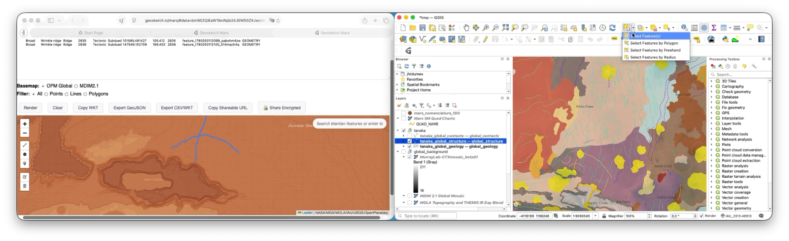
You can select one or more features (if features are too many you might just kill your browser… Be parsimonious) copy –> and paste in the dialog of the page above. This can be shared, looked at, modified, re-created, shared back via unique URL. Simple editing can also be performed in place.
graph LR
A2(You map
on GIS )
B2(You need
to iterate)
C2(Copy
your WKT )
D2(
Geosketch does not store data anywhere but your clipboard and your browser, i.e. is client-only. This can be advantageous privacy-wise, but it also means all data are encoded in the URL itself, thus the latter can become quite long. This is why it is recommended to iterate with small amount/volume of vector mapping each time. Also because they are geosnippets. Otherwise they would be called geomammoths, or so.
A video exemplifies more than many words:
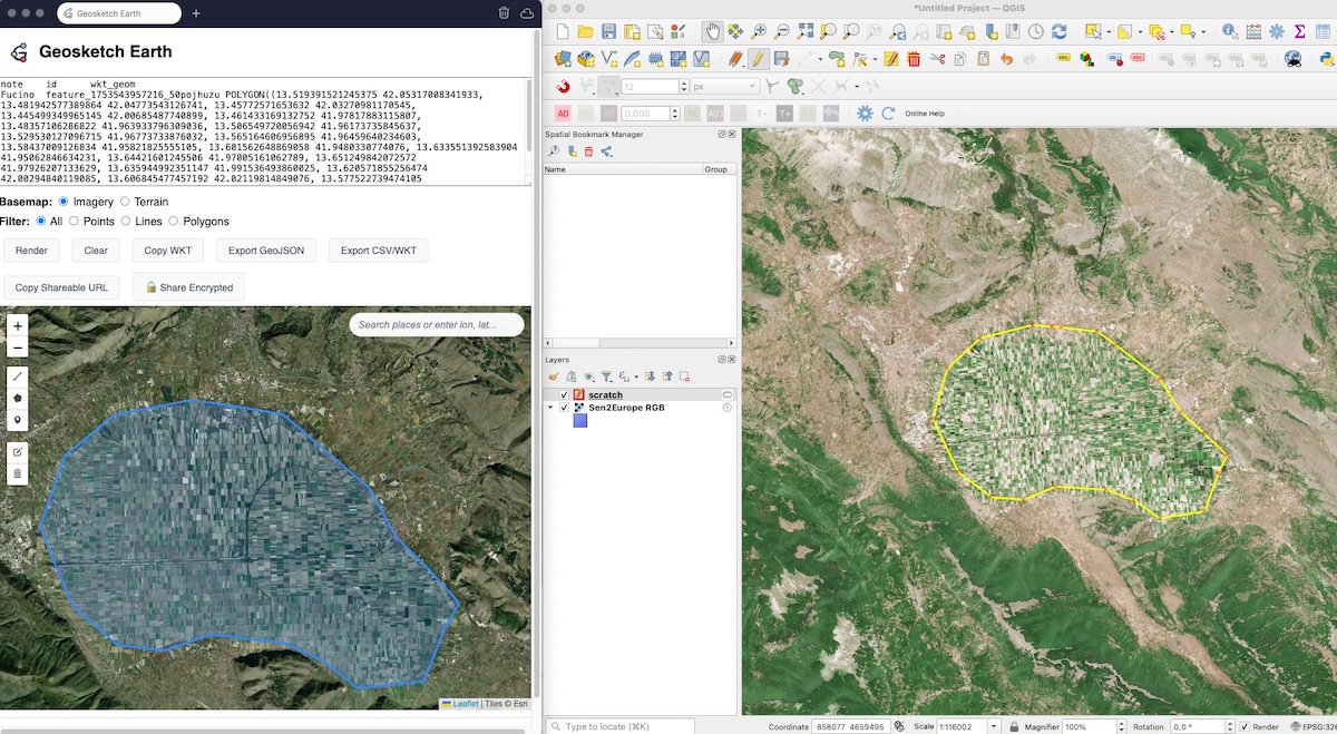
To be more precise, once the iteration is satisfying, you can paste back onto QGIS, i.e.:
graph LR
A3(You map
on GIS )
B3(You need
to iterate)
C3(Copy
your WKT )
D3(In fact, you don’t even need a GIS. Yes there is a ton of mapping services. You can use Google My Maps, or alike. Still, they stay on a server. Also, anything with a permalink does.
graph LR
D4 --> E4()
D4 --> F4()
D4(
Essentially Geosketch can be used as a quick and (not so) dirty way to share mobile mapping notes.
Meanwhile Geosketch has a little QGIS Plugin that makes sharing even faster:
Caveats:
Link to heading
- Do not paste too many features. While the web client might be robust enough to handle this, the URL sharing most likely breaks, somwhere along the road to the recipient.
- URLs are not permalinks: They are not stored anywhere but your clipboard, and if you change the content of the map, the URL deterministically changes, too. Thus, geosketches evolve with their link (i.e. 100 variations of map content → 100 URLs). The upside is that “data is always with you (it)”.
- Known issue: On mobile, while editing features on the map, fast finger lifts during polyline drawing may end the line prematurely (at 2nd touch): Solution → Please use slightly longer-lasting touches when adding vertices (it might need a little practice).

Acknowledgements
Link to heading
Thanks to MP, BC for triggering the idea through a joint project. Thanks go also to ARM, SVG, NM, TH, FC, FG, XR for having tested its early iterations. Thanks to one specific Shoggoth for support.
Notes
Link to heading
-
https://en.wikipedia.org/wiki/Geographic_information_system — Interestingly, John Snow is explicitly mentioned in the Wikipedia page for GIS. See also within One lustro later. ↩︎